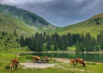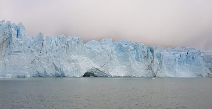
Ever wondered how those colossal ice rivers, glaciers, manage to carve out such dramatic landscapes? The short answer is: through a relentless, slow-motion grind of erosion and deposition. They’re like nature’s bulldozers, slowly but surely shaping mountains, valleys, and even entire regions over millennia. If you’re keen to understand the nitty-gritty of how they do it, you’re in the right place. Let’s dig in.
Before we can appreciate the geological artistry of glaciers, it helps to understand what they are and how they move. Think of them as incredibly slow-moving rivers of ice, but with far more power.
What Exactly is a Glacier?
A glacier isn’t just a big block of ice. It’s a persistent body of dense ice that is constantly moving under its own weight. This movement is what gives glaciers their incredible power to reshape the Earth’s surface. They form in areas where snow accumulation exceeds snowmelt over many years, causing the snow to compact and recrystallize into ice.
How Do Glaciers Move?
This is where the magic happens. Glaciers don’t just sit there. They move in a couple of key ways:
- Internal Deformation: Imagine a really thick, viscous liquid. The ice crystals within the glacier actually slide past each other, especially under pressure. This internal flow allows the glacier to bend and stretch.
- Basal Sliding: When the base of a glacier is at or near its melting point, a thin layer of meltwater can form between the ice and the bedrock. This water acts like a lubricant, allowing the entire glacier to slide over the ground. This is a very efficient way for glaciers to move and a major contributor to their erosive power.
If you’re interested in understanding how glaciers shape the landscape, you might also find it beneficial to explore related topics in environmental science and coding. For instance, learning how to analyze geographical data using Python can enhance your understanding of glacial movements and their impact on terrain. A great resource for this is the article on Python coding exercises, which can help you develop your programming skills while applying them to real-world scenarios. You can read more about it here: Python Coding Exercises to Enhance Your Python Skills.
The Power of Glacial Erosion
This is where glaciers truly make their mark. Their ability to wear away rock is astounding, creating some of the most dramatic landforms on Earth.
Plucking (Quarrying)
Imagine a giant, frozen crowbar. That’s essentially what plucking is. As a glacier moves over bedrock, meltwater can seep into cracks and crevices in the rock. When this water freezes, it expands, wedging pieces of rock loose. The glacier then “plucks” these loosened fragments, incorporating them into its icy mass. This process is particularly effective on fractured or jointed rock.
Abrasion
Once a glacier has plucked rocks, those rocks become tools. The embedded rock fragments, ranging from tiny grains to massive boulders, act like sandpaper as the glacier scrapes across the underlying bedrock. This constant grinding and scouring is called abrasion.
- Striations: The most direct evidence of abrasion are glacial striations. These are parallel grooves or scratches etched into the bedrock, indicating the direction of glacial movement. You can find them on exposed rock surfaces in glaciated areas.
- Polished Surfaces: Intense abrasion can also lead to highly polished rock surfaces, almost mirror-like in their smoothness, especially on harder rock types.
- Rock Flour: The finely ground rock created by abrasion is called rock flour. This incredibly fine sediment is often suspended in meltwater, giving glacial rivers and lakes their characteristic milky-turquoise color.
Glacial Deposition: Leaving Their Mark
It’s not just about taking away; glaciers also leave behind vast quantities of material. All that plucked and abraded rock has to go somewhere, and where it ends up tells a fascinating story.
Till and Moraines
The unsorted, unstratified sediment directly deposited by a glacier is called till. It’s a jumble of everything from fine clay to large boulders, reflecting the chaotic nature of glacial transport. When this till is deposited in distinct ridges or mounds, we call them moraines.
- Terminal Moraine: This marks the furthest extent of a glacier’s advance. It’s a ridge of till built up at the glacier’s snout (front).
- Lateral Moraines: These form along the sides of a valley glacier, composed of debris that has fallen onto the glacier from the valley walls and material scraped from the sides.
- Medial Moraines: When two valley glaciers merge, their adjacent lateral moraines can combine to form a single ridge of till in the middle of the newly formed larger glacier.
- Ground Moraine: This is a more widespread, generally undulating sheet of till deposited directly beneath a retreating glacier, covering the landscape like a blanket.
Other Depositional Features
Glaciers leave behind a variety of other interesting features, each with its own story.
- Drumlins: These are streamlined, elongated hills composed of till, with a steeper side facing the direction from which the glacier advanced. They often occur in “fields” and look a bit like inverted spoons.
- Kames: Irregularly shaped hills or mounds of sand and gravel deposited by meltwater flowing through cracks or holes in a stagnant or retreating glacier.
- Eskers: Long, winding ridges of sand and gravel, often resembling railway embankments. They form in tunnels or channels within or beneath the ice, as meltwater streams deposit sediment.
- Outwash Plains (Sandur): Beyond the terminal moraine, meltwater streams carry sediment away from the glacier, depositing it in broad, flat plains called outwash plains. These are typically composed of sorted sand and gravel.
Characteristic Glacial Landforms
Now let’s look at some of the distinctive shapes and features glaciers carve into mountains and valleys.
U-Shaped Valleys (Troughs)
This is perhaps the most iconic glacial landform. Rivers carve V-shaped valleys, but glaciers, with their immense width and erosive power, straighten, widen, and deepen existing river valleys, transforming them into characteristic U-shaped troughs. The valley sides become steep and the floor broad and flat.
- Hanging Valleys: Smaller tributary valleys, often less intensely glaciated, are left at a higher elevation than the main U-shaped valley. When the glacier melts, streams from these smaller valleys tumble over the edge of the main valley, often forming waterfalls.
- Fjords: If a U-shaped valley extends below sea level and is subsequently flooded by the ocean, it becomes a fjord. These are deep, steep-sided inlets of the sea, common in Norway, Alaska, and New Zealand.
Cirques (Corries or Cwms)
These are amphitheatre-shaped hollows found at the head of glacial valleys. They’re typically carved out by small, incipient glaciers.
- Formation: Snow accumulates in a hollow, compacts into ice, and begins to rotate, plucking and abrading the back wall and floor. This creates a steep back wall, steep sidewalls, and an overdeepened basin.
- Tarns: Often, after the glacier melts, the overdeepened basin of a cirque fills with water, forming a small, often circular lake called a tarn.
Arêtes and Horns
These sharp, jagged features are testament to intense glacial erosion from multiple sides.
- Arêtes: When two cirques form back-to-back or side-by-side on a mountain, the narrow, knife-edge ridge that separates them is called an arête.
- Horns: If three or more cirques erode a mountain peak from different sides, they can carve out a sharp, pyramid-shaped peak called a horn. The Matterhorn in Switzerland is a classic example.
Understanding how glaciers shape the landscape can be fascinating, and if you’re interested in exploring more about the dynamics of natural interactions, you might find it helpful to read about effective communication strategies. For instance, an article on how to approach someone about why they stopped talking to you can provide insights into interpersonal relationships that mirror the complexities of environmental changes. You can check it out here.
Studying Glaciers in Action and History
Understanding how glaciers shape landscapes isn’t just about looking at existing features; it also involves studying active glaciers and piecing together past glacial activity.
Modern Glacial Observation
Scientists today use a variety of methods to study active glaciers and their impact.
- Remote Sensing: Satellites and aerial photography provide invaluable data on glacier extent, movement rates, and changes over time. This is crucial for monitoring the effects of climate change.
- Ground-Based Measurements: Researchers on the ground use GPS, stakes, and radar to measure ice thickness, velocity, and subglacial conditions.
- Meltwater Analysis: Studying the sediment load and chemical composition of meltwater streams can give clues about the intensity of glacial erosion.
Interpreting Past Glaciation
Much of our planet has been shaped by glaciers that no longer exist, or have significantly retreated. Geologists act like detectives, using the landforms and sediments left behind to reconstruct ancient ice sheets.
- Geological Mapping: Identifying and mapping glacial features like moraines, drumlins, and striations allows scientists to reconstruct the extent and flow direction of past glaciers.
- Dating Techniques: Techniques like radiocarbon dating of organic material within till or optically stimulated luminescence (OSL) dating of sediments can help determine when glacial events occurred.
- Paleo-Environmental Indicators: Pollen analysis, fossil studies, and ice cores provide additional context about past climates and environments, which in turn informs our understanding of glacial cycles.
Understanding how glaciers shape the landscape can be fascinating, and if you’re interested in exploring the processes behind natural phenomena, you might also enjoy learning about the intricate methods involved in everyday products. For instance, the article on how coffee creamer is made delves into the science and techniques that transform simple ingredients into a staple of many people’s morning routines. Both topics highlight the remarkable ways in which nature and human innovation interact to create the world around us.
Putting It All Together: A Glacial Story
Learning about glaciers isn’t just memorizing terms; it’s about seeing the landscape as a dynamic canvas, constantly being painted, erased, and repainted by natural forces. When you look at a rugged mountain range or a rolling plain covered in drumlins, you’re looking at the story of ice and rock, written over millions of years.
The next time you see a U-shaped valley, or a perfectly carved cirque, you’ll know it wasn’t just random weathering. It was the patient, powerful work of a glacier, slowly but surely shaping our world, leaving behind a legacy of breathtaking beauty and geological wonder. Keep exploring, keep observing, and you’ll find these stories everywhere.